In 2023 I started taking firearms training courses with the goal of becoming an instructor. I have enjoyed shooting sports since high school. I was a target rifle shooter in high school and college, and I have long followed the shooting sports events in the Olympics. Now, in retirement, I am again shooting rifles competitively. But this is the first time that I have taken formal classes with the intention of becoming an instructor. It's been great!
Sunday, December 31, 2023
Firearms Training
In 2023 I started taking firearms training courses with the goal of becoming an instructor. I have enjoyed shooting sports since high school. I was a target rifle shooter in high school and college, and I have long followed the shooting sports events in the Olympics. Now, in retirement, I am again shooting rifles competitively. But this is the first time that I have taken formal classes with the intention of becoming an instructor. It's been great!
Friday, November 3, 2023
Cameo Shooting and Education Complex
The Cameo Shooting and Education Complex (CSEC) near Grand Junction, Colorado, is impressive:
- The Action Shooting Pavilion at the main complex includes 20 bays for pistol and rifle shooting up to 200 yards. There is also an archery bay and a picnic pavilion.
- Options for shotgun shooting include two sporting clays courses and 5-stand.
- There are four 3D archery courses.
- The Long Range Precision (LRP) range has 35 targets with flashing electronic hit indicators at distances from 100 to 2,000 yards. That's more than a mile!
- The 850-acre Terrain Park includes a mountain bike biathlon course.
Friday, August 13, 2021
Varnum Memorial Library
The Varnum Memorial Library is a gem in my village of Jeffersonville, Vermont (town of Cambridge). This post is to celebrate the new roof that was put on the library today.
The crew of Three Mountain Roofing started early today. They were well into the job when the following two photos were taken around 8:30 AM.
And they were done by early afternoon! The photo at the top of this post, and the two photos below, were taken around 2:30 PM.
The Varnum Memorial Library is owned by the Crescendo Club Library Association, Inc. The library operates as a public-private partnership between the CCLA and the Town of Cambridge.
The Crescendo Club was organized in 1898 by local women to provide free public library services to their community. The Crescendo Club incorporated as the CCLA in 1927 following the death of Mrs. Harvey Varnum who willed her residence to the club. That property was sold, and the proceeds (together with other funds) were used to construct the original library building in 1938. The addition in the rear was constructed in 2005.
Saturday, July 24, 2021
Sunkhaze Meadows NWR
Sunkhaze Meadows National Wildlife Refuge is located in Milford, Maine, about 15 miles northeast of Bangor. Nancy and I had not heard of it before this year.
The NWR consists of more than 11,000 acres that include the second largest peat bog in Maine. There were plans in the early 1980s to mine the peat deposits, which reach depths of 15 feet or more, but the U.S. Fish & Wildlife Service acquired the property in 1988 and protected it.
In addition to the peatland complex of several raised peat domes, the NWR includes wetlands and uplands with a wide variety of plants and animals. More than 200 species of birds have been identified in the forests and swamps. Larger mammals found in the refuge include beaver, muskrat, otter, mink, moose, white-tailed deer, black bear, coyote, fisher, snowshoe hare, and porcupine.
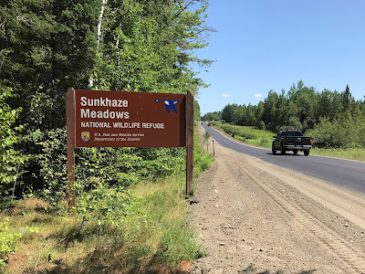
The U.S. Fish & Wildlife Service website for Sunkhaze Meadows National Wildlife Refuge does not explain how to get there, so here are directions. From US-2 in Milford, turn east on County Road (0.0 miles). There is a large sign at about 4.1 miles (photo above). County Road becomes a dirt road at about 4.4 miles. The gated Carter Meadow Road is on the left at about 6.1 miles. Continue another 150 yards or so to the small parking lot at 6.2 miles (photo below).
There are few facilities in Sunkhaze Meadows. There is no visitor center. It is mostly a wild place. There are four small parking areas like the one described above. The best information about the refuge is on the signs and in the brochures at these parking areas. See below for the map from one of these brochures:
There are about 10 miles of semi-maintained trails accessible from three of the parking areas. The fourth parking area provides access to Ash Landing, a canoe/kayak launch on the northeastern side of the refuge. Sunkhaze Stream runs through the refuge from northeast to southwest for nearly five miles and empties into the Penobscot River west of the NWR.
From a brochure that we picked up at the refuge:
The name Sunkhaze is derived from the Abnaki phrase Wetchi-sam-kassek which, roughly translated, means "concealing outlet," referring to the stream's well disguised confluence with the Penobscot River.
McLaughlin Road runs through the western part of the refuge. This 2-mile gated dirt road is open to bicycles, motor vehicles during the fall hunting season, and snowmobiles in the winter.
The State of Maine lists Sunkhaze Meadows as one of its Focus Areas of Statewide Ecological Significance. See the Sunkhaze Meadows Factsheet (pdf).
Sunkhaze Meadows NWR includes three smaller satellite units located some distance away in other parts of Maine. This post is not about those units.
Saturday, June 19, 2021
Lockdown Ends in Vermont
The lockdown in Vermont from the COVID-19 pandemic has ended. Governor Phil Scott declared a State of Emergency on March 13, 2020, that originally extended to April 15, 2020. The State of Emergency was extended month to month until it was allowed to expire at midnight on June 15, 2021. The State of Emergency was in effect, with varying levels of restrictions, for 15 months.
The following graphs show the state of COVID-19 in Vermont during this period:
The 7-day average of new cases per day has been below 15 since May 29 and is trending toward zero. There has been only one death attributed to COVID-19 since May 16.
I published these graphs at the end of May last year (link). At the time, COVID-19 was fading away. In fact, the pandemic in Vermont was minimal all last summer. It came roaring back last fall, worse than the initial wave, as shown in the graphs above.
Why do we think this year will be different? Why are we not concerned about another wave in the fall? Because of the vaccines.
In December 2020 the U.S. Food and Drug Administration approved COVID-19 vaccines developed by Pfizer and Moderna. The FDA approved a third vaccine by Johnson & Johnson in February 2021. (Links are to the FDA approvals.)
The single-dose Johnson & Johnson vaccine has not been a significant factor, partly because of production problems and partly because of concerns about side-effects. The Pfizer and Moderna vaccines, which require two doses spaced three or four weeks apart, have been widely used and are highly effective. The Pfizer and Moderna vaccines are a revolutionary new technology called mRNA vaccines.
Supplies of the Pfizer and Moderna vaccines were initially limited, but soon ramped up. Oldest people generally received the vaccine first in Vermont. The first doses were administered before the end of December 2020. Nancy and I received our two doses in March 2021. Starting April 19, all Vermonters age 16 and older could register for a vaccine (link). Walk-in clinics, with no registration required, opened soon thereafter.
Governor Phil Scott had stated that the lockdown would end when 80% of eligible Vermonters had received at least one dose of any of the three vaccines. He announced on June 14 that this threshold had been reached (link). This news in Vermont made the front page of the Wall Street Journal on June 15 (link) with a dateline of Fairfax, a town adjacent to my town of Cambridge.
Saturday, April 24, 2021
Mount Kearsarge
The name of the mountain evolved from a 1652 rendering of the native Pennacook tribal name for the mountain, Carasarga, which it is surmised means "notch-pointed-mountain of pines".
Friday, January 1, 2021
Northeast Kingdom Adventures
We celebrated New Year's Day this year with adventures in Vermont's Northeast Kingdom. Yes, there is plenty to see and do right here in northern Vermont, even in the midst of a pandemic lockdown and even in winter – without skiing.
NEK Odds and Ends
Our Northeast Kingdom Adventures today took us on many back roads with interesting sights. The marker above is on Lake Shore Road on the west side of Caspian Lake in Greensboro:
1781
Near This Spot By A
BLOCK HOUSE
Guarding
HAZEN ROAD
Two Scouts
CONSTANT BLISS
and
MOSES SLEEPER
Were Killed By Indians
And Buried Where They Fell
Lest We Forget The Pioneers
This Memorial Was Erected
1941
"Hazen Road," usually called the Bayley-Hazen Road, was a military road constructed during the Revolutionary War in what is now northern Vermont. This 2017 article in the Burlington Free Press has more background about the monument above: Search for the Greensboro blockhouse.
Our travels took us by several interesting agricultural enterprises including Kingdom Creamery in Hardwick, Shat Acres Highland Cattle in Greensboro, Pete's Greens in Craftsbury, and the modern (2015) hay drying operation of Jasper Hill Farm. Jasper Hill Farm makes award-winning cheeses at their farm in Greensboro and at the Center for an Agricultural Economy in Hardwick; the hay drying facility is in Craftsbury. Dry hay is critical to the flavor of their cheeses, three of which are named Bayley Hazen Blue, Moses Sleeper, and Constant Bliss (not currently in production).
Hardwick, where we entered the Northeast Kingdom on today's tour, was once known as the "Building Granite Center of the World." That industry died out about a century ago and the town declined for a time, but:
Over the past few years, Hardwick, Vermont, a typical hardscrabble farming community of 3,000 residents, has jump-started its economy and redefined its self-image through a local, self-sustaining food system unlike anything else in America.
Source: the description at Amazon.com for the 2011 book The Town That Food Saved by Ben Hewitt. Some of the businesses mentioned above are discussed in this book.
We drove by this sign in Hardwick:
The sign says: "The Highfields Institute / West Hill Farm / Compost Demonstration & Research Site / Promoting On-Farm Composting." The Highfields Institute, later the Highfields Center for Composting, is also written up in Ben Hewitt's book The Town That Food Saved, but the organization was dissolved in 2014.
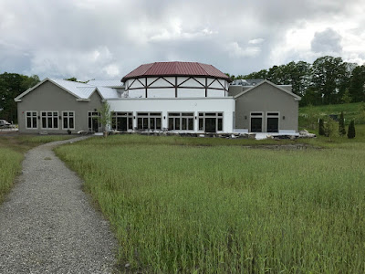
We also drove by something that one does not expect to see in rural Vermont: a $14 million theater in Greensboro modeled on the Globe Theatre in London:
Northeast Kingdom Adventures: Follow the link for the introductory post about this series and a list of all the posts in the series.
Barr Hill Natural Area
Barr Hill overlooks Caspian Lake in Greensboro, Vermont. We hiked most of the yellow trails on Barr Hill today, enjoying the overlooks in all directions, and some of the black trails including the Mossy Trail (see trail map below, click on the image to enlarge):
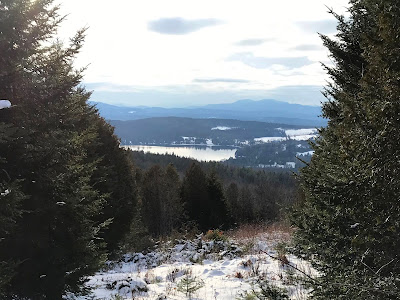
The photo at the top of this post is looking southwest. The view below is looking northwest; Belvidere Mountain is on the horizon near the center of the photo.
The Barr Hill Natural Area consists of 256 acres owned and managed by The Nature Conservancy in Vermont. The trails there connect to the trails at the Highland Lodge on Caspian Lake and the extensive trail system at the Craftsbury Outdoor Center.
Barr Hill Gin and Barr Hill Vodka, made by Caledonia Spirits, are named for Barr Hill in Greensboro. Click here for that story.
Northeast Kingdom Adventures: Follow the link for the introductory post about this series and a list of all the posts in the series.
Museum of Everyday Life
The Museum of Everyday Life is on Dry Pond Road (aka Vermont Route 16) in Glover just north of the rest stop and picnic area for Runaway Pond. We were the first visitors to sign the guest book in 2021. The signs said to turn the lights on when entering, turn them off when leaving, wear a face mask and use the hand sanitizer during the COVID-19 pandemic, and consider leaving a donation.
The main exhibit in this museum is about a single theme, something in ordinary life, and the theme changes annually. The current exhibition is about knots. Previous exhibitions have been about scissors, mirrors, matches, dust, and many other things. The museum includes selected items from previous exhibitions.
Once you start thinking about knots, they are everywhere! Below I am looking at the exhibit on different ways to tie a necktie.
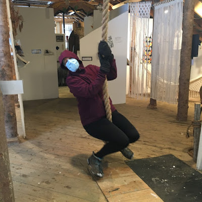
Hanging from the rafters was a rope swing with a huge knot at the bottom to sit on. We all enjoyed that! Here Nancy takes a turn:
The Museum of Everyday Life is in an old, unheated barn, hence the winter clothes. We did not see anyone else during our visit.
The museum's website is a rich, fascinating source of information. The Philosophy Department provides insight into what the museum is all about. The News page lists media articles about the museum, including this March 2019 article in the New York Times.
Northeast Kingdom Adventures: Follow the link for the introductory post about this series and a list of all the posts in the series.
Runaway Pond
Vermont State Route 16 north of the Greensboro-Glover town line is also known as Dry Pond Road. Five miles south of Glover is the rest stop and picnic area shown above. The historic marker tells the story:
RUNAWAY POND
On this site, on June 6, 1810 settlers dug an outlet to the north from what was then known as Long Pond. The retaining bank collapsed, causing all water from the 1.5-mile long pond to be discharged toward Barton River, and on to Lake Memphremagog, with extensive damage to the countryside, but no loss of life.
The plaque in the photo below adds more details:
LONG POND / RUNAWAY POND / DRY POND
In 1810 the water level of Long Pond was 70 feet above this marker and the water flowed south into Greensboro and the Lamoille River.
Needing more water to power Aaron Willson's grist mill in Glover, 60 men and boys dug a ditch on the north shore (about .5 miles north of here) to cause the water to flow into the Glover/Barton River.
Due to the quicksand in the earth, the entire hillside washed away and the pond "ran-a-way" discharging its billion gallons of water toward the mill in 1.5 hours.
Spencer Chamberlin raced ahead of the wall of water for 5 miles and saved the miller's wife.
Glover Historical Society 1996
It was thought-provoking to stand at that picnic area, look at the steep hillsides surrounding the narrow valley, and contemplate how they once contained a 70-foot deep pond that drained in just 1.5 hours.
Northeast Kingdom Adventures: Follow the link for the introductory post about this series and a list of all the posts in the series.
Camp Wapanacki
- by the current owners
- by the New York Institute for Special Education
- the New York Times obituary for Dr. Frampton


